Scientists in the Earth and Environmental Sciences Area are committed to developing transformative AI applications that expand the boundaries of Earth science discovery.
AI offers powerful new ways to generate insights and actionable solutions for challenges that depend on understanding and predicting Earth-system behavior, from energy security to water resilience. EESA researchers leverage Berkeley Lab’s team science heritage to lead the application of innovative AI and machine learning (ML) methods and data solutions for advancing Earth and environmental science. This work draws on expert understanding and observations of processes that occur from the atmosphere to nearly a mile belowground — knowledge and data essential for training AI to learn from nature and capture Earth’s full complexity.
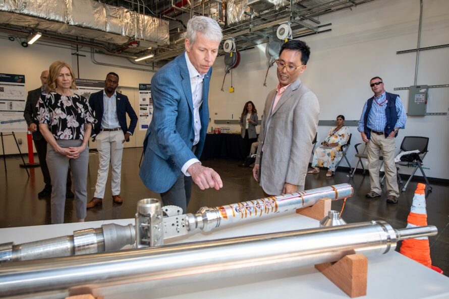
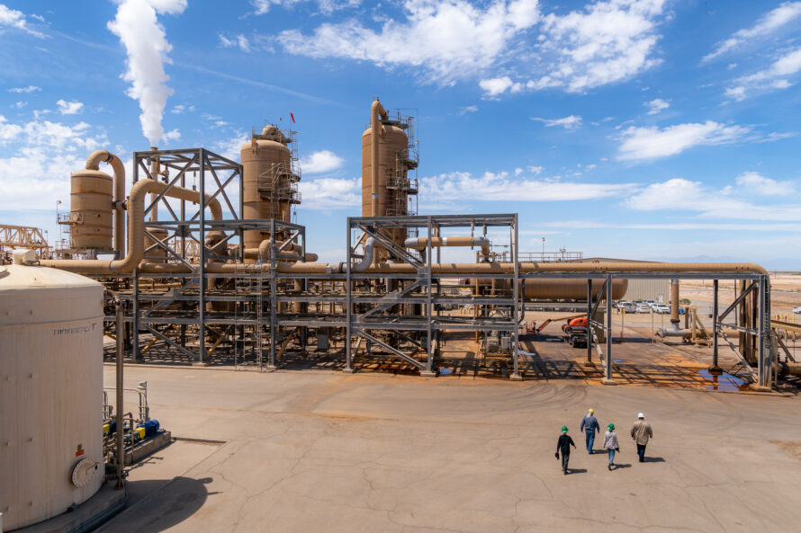
Eighty percent of the nation’s energy originates in Earth’s subsurface, and energy demand is expected to increase due to the growth of AI data centers. Yet we still lack the ability to observe and manage the subsurface with the precision needed to optimize energy production. EESA integrates AI and ML to improve subsurface observation for expanded energy production while reducing environmental and infrastructure risks. Our teams are developing an AI framework that enables real-time subsurface monitoring, prediction, and management, focused on understanding how subsurface systems function. The goal is to strengthen exploration, siting, and risk mitigation for oil and gas, geothermal, hydrogen, and carbon storage. This framework compiles AI-ready datasets, develops hybrid models, adds new field observations, and builds digital twins with agentic workflows.

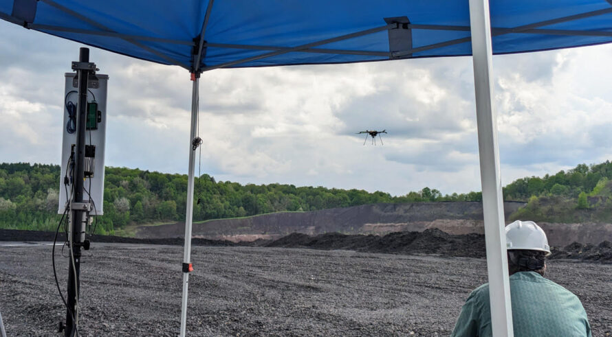
Meeting future demand for rare earth elements and other critical minerals needed for energy technologies could require mining 3.5 billion tons of rock by 2050–yet most of what is mined is currently wasted. EESA scientists use AI-enabled sensors, autonomous labs, and large language models to reveal processes shaping mineral systems. By understanding how minerals behave under different conditions, we can better locate them in the subsurface, improve ore processing, and more efficiently convert raw materials into usable forms. As one example, with neodymium demand projected to rise up to 48% by 2050, EESA researchers have developed drone-based sensing that combines magnetic, radiometric, and hyperspectral data with AI to pinpoint high-value zones in mine waste, and hybrid physics-informed neural networks to optimize extraction from coal tailings.

Rapidly growing water demands require solutions that can be deployed quickly and at scale. Our scientists develop AI-enabled solutions to track and predict water availability and water quality across watersheds and major river basins, even in regions with little existing data. We pair these innovations with high-resolution observational and modeling frameworks capable of capturing water-cycle complexity and assessing watershed resilience to drought and other stressors. Our teams generate extensive datasets from high-resolution remote sensing, advanced sensor networks, and numerical simulations – to train AI models that improve predictions of snowpack, streamflow, vegetation water use, and water quality, supported by 5G-enabled field-to-computing facility workflow integrations. Because groundwater provides about 40% of water in the US, we also develop AI models fusing different types of datasets to forecast aquifer behavior and support sustainable groundwater management.
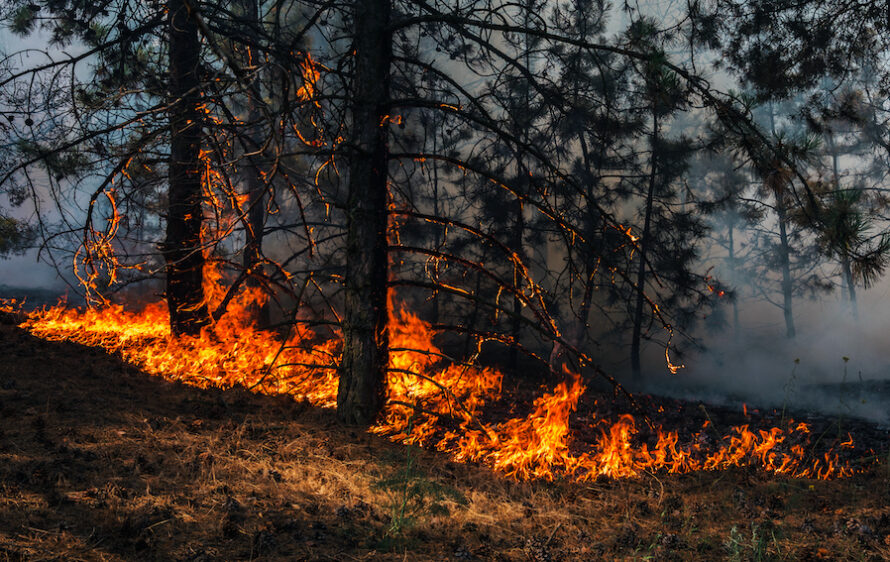
Understanding and predicting complex environmental systems is critical because natural hazards emerge from many interacting processes. AI accelerates the simulations needed to forecast seismic activity, hydroclimate conditions–uncovering patterns that strengthen the resilience of natural ecosystems and the built environment. At EESA, we use AI/ML to develop new ways to detect, quantify, and provide early warnings for natural and induced hazards that impact critical infrastructure and societies. We integrate AI with field data, remote sensing, and numerical models to forecast heat waves, earthquakes and wildfires, assess the impacts of droughts and floods, and analyze vast quantities of seismic signals during geothermal production to predict induced seismicity.

Our researchers use AI together with water-energy flux towers, soil and plant sensors, remote sensing, and stable isotope tracing to study carbon exchange and develop AI-driven Earth system models to understand and predict ecosystem processes. AI is also improving how soil-plant-microbe interactions are represented in ecosystem models, enabling spatially explicit predictions of microbial and biogeochemical processes across diverse landscapes. Together, these efforts deliver more accurate assessments of soil and plant health and overall ecosystem function. EESA is also contributing to the development of pipelines to unify diverse biological and environmental datasets, from microbial traits and fungal genomes to biogeochemical fluxes, using standardized ontologies and shared metadata frameworks. These platforms will facilitate scalable integration of data streams from the integrated research underway in the new Biological and Environmental Integration Program Center at Berkeley Lab, support model benchmarking, and accelerate discovery.

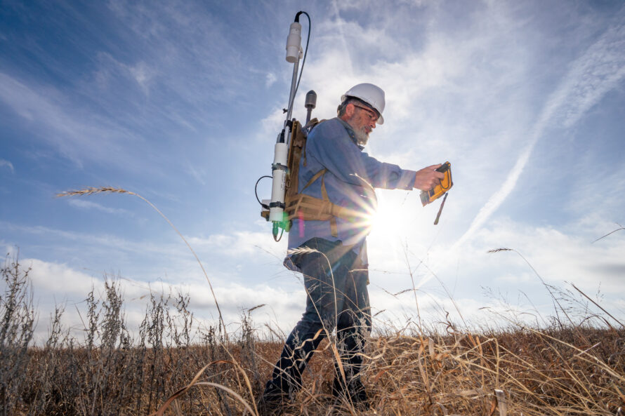
AI can only predict ecosystem change effectively when trained on rich, high-quality data that capture how Earth’s systems vary across space, time, and environmental conditions. EESA provides this foundation, by combining decades of field sensing and engineering experience with custom advanced instrumentation–from satellites and drones to fiber-optic networks and autonomous field sensors–to generate diverse Earth observations across complex, rapidly changing environments. We build systems to archive environmental data in standardized formats that are accessible and ready to use, use large language models and agentic workflows to accelerate data discovery, and develop data pipelines that transform raw observations into integrated AI-ready data products. Our researchers are developing interpretable AI methods to gain new insights into Earth system processes and make predictions vital to energy and water resilience.
Recent Publications
We’re applying expertise in machine learning and environmental data acquisition to drive AI innovation for energy security.
To find forgotten oil and gas wells in California and Oklahoma, we used AI to search historical maps–quickly leveraging data to address a decades-old problem.
Berkeley Lab’s integrated, AI-enabled sensing system maps subtle signals to locate “hot zones” rich in critical minerals such as neodymium and dysprosium.
